USE OF REMOTE SENSING IN BASIC SCIENCE I:
MEGA-GEOMORPHOLOGY
Most of the categories, like those above, involving use of remote sensing would not be classed under a heading of "Basic Science" studies, although principles of science - such as the physics of electromagnetic radiation - are involved. Purists would probably argue that information about such space "observables" as determining ozone distribution worldwide, measuring heat flow in the oceans, and observing the biomes and their seasonal variation over the continents augments the subject matter normally associated with basic science. Perhaps the best examples of contributions of remote sensing to the fundamentals of science are those associated with planetary exploration and astronomy. Likewise, some observations of a geological nature fall more into this "science" niche than into some applications discipline. In this Section, we will illustrate that contention by surveying how remote sensing has been a large factor in creating a new subfield in the science of Geology: Global Mega-Geomorphology.
Geomorphology is the study of the shape or configuration of the Earth's (or, by extrapolation, any other planetary body) solid surface - both above and below ocean level, involving the classification of landforms and the processes by which they develop. The term "physiography" is closely related, referring both to the description and evolution of land forms. By implication, water bodies, from oceans to small creeks, are participants in geomorphic processes as major formative agents even though their shapes tend to be transient and flat in detail.
Until the space age, most geomorphic analysis was conducted by
mapping - generally topographic (for shape) and geologic (for
structure and underlying rock types) - and by field observations
and measurements. The observation scales tended to be local or
over relatively small areas. Aerial photographs became a prime
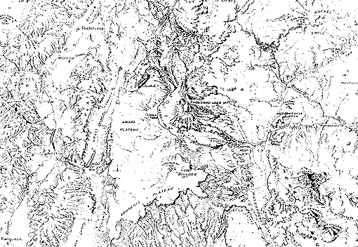
tool for mapping and interpretation. Landforms were commonly depicted
as physiographic maps - using an artist's sketch technique to
convey a three-dimensional oblique perspective (exemplified top
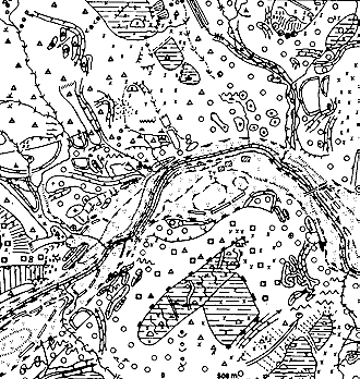
below for part of the State of Utah), or, less often, as geomorphic
units maps (shown beneath for an area in Scotland).
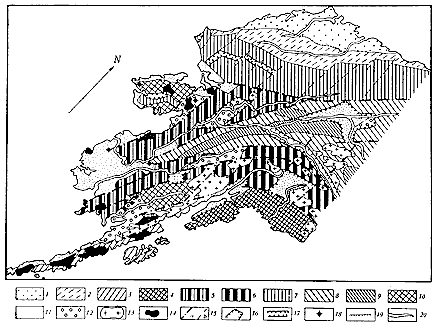
Geomorphic maps covering large areas - regional in scale - have
not been commonplace. In the 1980s, multi-colored maps of Europe
and North Africa were been produced by a consortium of geomorphologists.
An example of a regional map, here showing much of Alaska, made
by Soviet scientists, is reproduced below (the units are deliberately
unidentified owing to the complexity of their descriptions).
However, in general studies and analysis of landforms at the scales best suited to the broad coverage afforded by space imagery were limited, even after the wide availability of Landsat and SPOT products. Within a few years after launch, they had achieved nearly cloud-free global coverage (about 11000 individual Landsat frames) of the Earth's land surface (exceptions: the polar regions and some oceanic islands). The ability to combine Landsat or SPOT images into mosaics, such as the one of southern Asia shown in Section 7, greatly aids the pictorial expression of regional landforms. In effect, the entire world can now be represented in picture rather than sketch format, so that there is then an actual depiction of landforms (generally the most obvious features at small scales) of a truly global extent.
Code 935, Goddard Space Flight Center, NASA
Written by: Nicholas M. Short, Sr. email: nmshort@epix.net
and
Jon Robinson email: Jon.W.Robinson.1@gsfc.nasa.gov
Webmaster: Bill Dickinson Jr. email: rstwebmaster@gsti.com
Web Production: Christiane Robinson, Terri Ho and Nannette Fekete
Updated: 1999.03.15.