load russia
[map2,maplegend2] = country2mtx('russia',map,maplegend);
figure
worldmap('russia');
meshm(map2,maplegend2)
polcmap
| Mapping Toolbox | Search Help Desk |
| country2mtx | Examples See Also |
Construct a matrix map for a country in the worldlo database
Syntax
[map,maplegend] = country2mtx(countryname,scale)
[map,maplegend] = country2mtx(countryname,scale,latlim,lonlim)
[map,maplegend] = country2mtx(countryname,map1,maplegend1)
Description
[map,maplegend] = country2mtx(countryname,scale) constructs a regular matrix map of a country in theworldlo POpatch database. The scale factor represents the number of matrix entries per degree of latitude and longitude (e.g., 10 entries per degree, 100 entries per degree). The scale input must be scalar. The returned matrix has values of 0 in the interior of the country, 1 on the border and 2 in the exterior.
[map,maplegend] = country2mtx(countryname,scalelatlim,lonlim) uses the two-element vector latitude and longitude limits to define the extent of the map. If omitted, the limits are computed automatically.
[map,maplegend] = country2mtx(countryname,map1,maplegend1) uses the limits of the provided map.
Examples
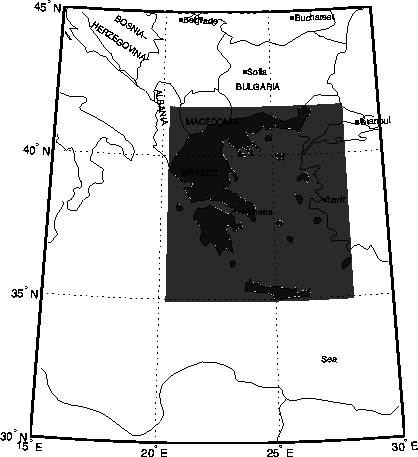
[map,maplegend] = country2mtx('greece',50);
worldmap('greece');
meshm(map,maplegend)
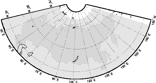
load russia
[map2,maplegend2] = country2mtx('russia',map,maplegend);
figure
worldmap('russia');
meshm(map2,maplegend2)
polcmap
Limitations
country2mtx may not fill properly if the vector data extends beyond a pole.
See Also
vec2mtx |
Regular matrix map from vector data |
ltln2val |
Returns map code value associated with positions |
imbed |
Encodes data points into a regular matrix map |
encodem |
Fills in indexed maps with specified seeds |
interpm |
Interpolates vector data to a specified data separation |