Radar units were first flown on military aircraft during World War II (these used very long (1 to 10 meters) wavelengths that extended into the radio region of the EM spectrum. Airborne SLAR systems were developed soon thereafter. The first radar systems in space had military applications, so that resulting imagery was classified. The first civilian use of spaceborne radar was the Seasat system operated for NASA by the Jet Propulsion Laboratory (JPL). Launched on June 26, 1978, the onboard SAR radar lasted only 99 days before a circuitry failure shut it and other sensors down. Its L Band (23.5 cm) transmitter produced a focused 1 x 6 degree HH-polarized beam pointed starboard at 20 degree off nadir (vertical). From a slightly elliptical, near polar orbit at a nominal altitude of 790 km [495 miles], Seasat's radar has an outward swath width of 100 km (62 miles), giving an image that can be printed as four individual strips of 25 km each and then combined to full width. Along any given track (reoccupied every 24 days), this swath has near and far boundaries that lie between 24 and 240 km (15 - 150 miles) off nadir. The high depression angles between 67 and 73 degrees ranged by the fixed-look beam reduces shadow effects in rugged terrains but induces notable layover. The resolutions achievable by the radar depend on the method by which the synthetic aperture data are processed. With an optical correlator, image resolutions can be as low as 70 - 80 m (230 to 260 ft) ; a digital correlator improves resolution to about 25 m (82 ft).
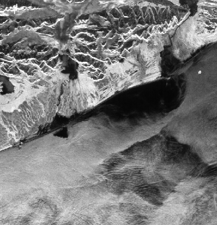
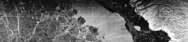
Seasat's principal mission was to study various properties at and near the ocean surface, including sea surface temperature, wind speeds, and wave heights. The SAR, with its low look angle, was designed to measure directions and wavelengths of ocean waves exceeding 50 m (162 ft) in fetch (distance between crests), and to look at sea ice. Below is an image made with the digital correlator of waves off Alaska's southern coastline near Yakutat (note glaciers on land); the image strip below it shows sea ice off Banks Island, Canada.
You have already witnessed two Seasat images of land surfaces - the Pine Mountain and Harrisburg scenes. As another example, examine this Seasat image of central Jamaica in the Carribean obtained through cloud cover on August 8, 1978.
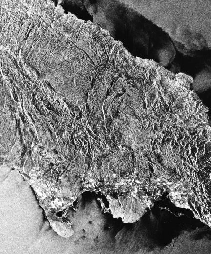
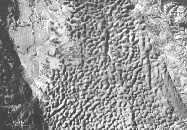
The image shows a variety of landforms, some of mountains that are rendered as foreshortened, areas of land use, and roughened offshore waters. Much of the island's underlying geology is governed by limestone beds that, in this area of heavy rainfall, are readily dissolved to form typical karst topography. Doline depressions (solution pits) occupy large sections of the scene. These are obvious as seen in the aerial photo below but in the Seasat image form a fine texture that may not show up well on your monitor. If it does, look also for a faint but visible lineation caused by fractures that have a preferred orientation owing to look direction.
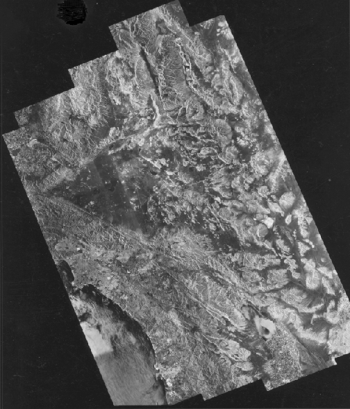
Like aerial radar imagery, space radar imagery is well suited to mosaics, as strikingly depicted below in this JPL mosaic of southern California. Use the DEM mosaic of much the same region that was presented in Section 7 on Mosaics as a locator guide (find Los Angeles).
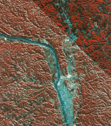
Seasat radar can also be co-registered with Landsat imagery; part of a Landsat image of dissected Allegheny Plateau in West Virginia, seen alone in the upper right, is here superimposed on a Seasat image giving a new impression of apparent relief by virtue of the light tones in the foreshortened foreslopes.
Code 935, Goddard Space Flight Center, NASA
Written by: Nicholas M. Short, Sr. email: nmshort@epix.net
and
Jon Robinson email: Jon.W.Robinson.1@gsfc.nasa.gov
Webmaster: Bill Dickinson Jr. email: rstwebmaster@gsti.com
Web Production: Christiane Robinson, Terri Ho and Nannette Fekete
Updated: 1999.03.15.