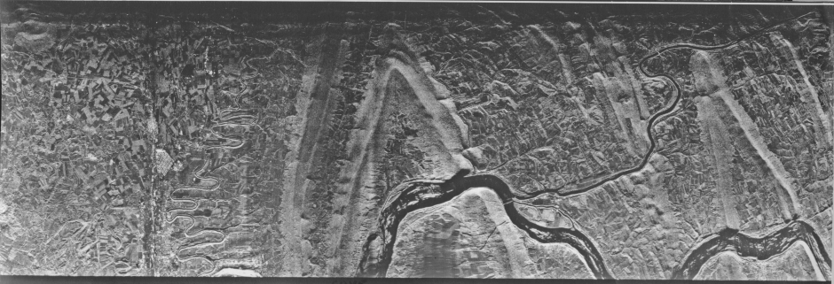
In the image, river surfaces, roads and streets, being smooth and flat, are displayed as dark whereas buildings, being strong corner reflectors, tend to be light (bright). Moist and bare fields are shown in various darker shades but those with crops have lighter tones. The more rugged terrain (ridges with notable topographic relief) resemble those in an aerial photo in which hill shadows are prominent, as at lower Sun angles. The brighter slopes are oriented towards the aircraft (located along bottom of image), at near range. Note that as the look angle increases (towards top), a general darkening (owing to overall drop in signal return) and more distortion of terrain features ensue.
By flying the radar along parallel flight lines such that the illumination always comes from the same direction (thus, during a mission the aircraft would not acquire signals during each return pass before traversing the next forward run) and appropriate incidence angles are maintained, strips of images can be acquired with identical shading characteristics which allows these to be merged into mosaics. The image below is a composite of radar strips taken during a flight series over an uneven hilly terrain making up part of an igneous/metamorphic shield in the Nigeria/Cameroon border region of western Africa. This mosaic is about 97 km (60 miles) on a side.
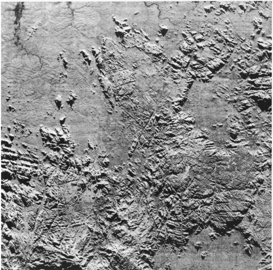
Even though the surface is heavily vegetated (tropical forests), the penetrating radar shows mainly its topographic character and is particularly adept at singling out fracture systems that have been weathered out into narrow valleys.
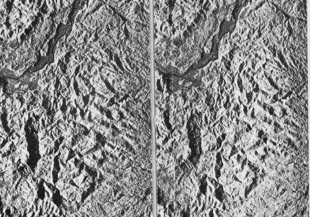
Successive flight lines can be set to obtain sidelap imagery in which part of the same area in each line strip appears in the adjacent strip but viewed at different angles. (In principle, two side-looking radars operating simultaneously at different look angles from the same platform can achieve a comparable effect.) This allows viewing in stereo which, despite distortions in terrain shapes, further aids in topographic characterization and analysis. Examine the two images (from the western U.S.) below stereoscopically to check out this effect.
From T.M. Lillesand and R.W. Kieffer, Remote Sensing and Image Interpretation, 2nd Ed., © 1987. Reproduced by permission of J. Wiley & Sons, New York.
Code 935, Goddard Space Flight Center, NASA
Written by: Nicholas M. Short, Sr. email: nmshort@epix.net
and
Jon Robinson email: Jon.W.Robinson.1@gsfc.nasa.gov
Webmaster: Bill Dickinson Jr. email: rstwebmaster@gsti.com
Web Production: Christiane Robinson, Terri Ho and Nannette Fekete
Updated: 1999.03.15.