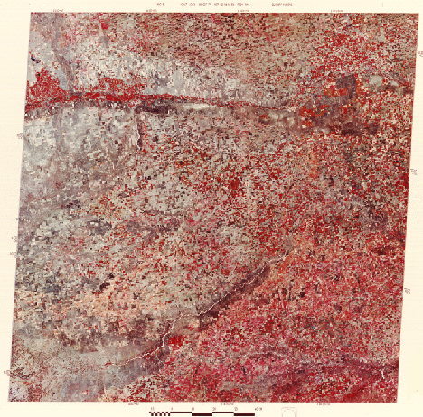

also acquired in October, we are now in the Great Plains of southwestern Kansas. During Fall and Winter, from the air the ground has a grayish-brown look that intensifies even further to the west in Colorado. This is also evident in parts of this scene wherever farm crops have not blotted out their underlying soils (i.e., currently fallow) or the natural surfaces have yet to be converted to agriculture. An example occurs in the lower left corner where the Cimarron River has developed gullied "badlands" (dendritic drainage) in soft sediments. Note that many farms are square in shape and are often just one square mile in size: these correspond to the section divisions in the Township-Range system of land mapping that was adopted in the 19th century in the United States. Near the upper right corner are clusters of circular pivot-irrigation fields, like those you were shown in Section 3. These lie along the Arkansas River just to the west of the largest town, in this part of the state, Garden City. As a generalization, the Great Plains scene appears much like that of the Interior Lowlands - both characterized by the dominance of farming in land use. On the ground, the Kansas landscape has a more "western" look owing to the semi-desert vegetation including grasses and sage-like shrubs. You probably have observed that there is more red in the eastern (right) half of the image than to the west. This is explained by differences in crop type and stage: wheat is more common in the west part of the image and according to the harvesting schedule those higher and somewhat cooler western lands had been culled at earlier fall times.
Code 935, Goddard Space Flight Center, NASA
Written by: Nicholas M. Short, Sr. email: nmshort@epix.net
and
Jon Robinson email: Jon.W.Robinson.1@gsfc.nasa.gov
Webmaster: Bill Dickinson Jr. email: rstwebmaster@gsti.com
Web Production: Christiane Robinson, Terri Ho and Nannette Fekete
Updated: 1999.03.15.