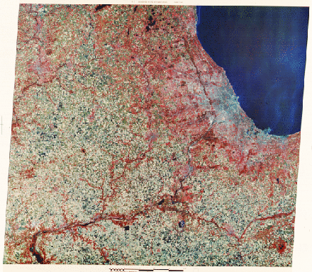
The governing rock type in this province is limestone but nearly all of the surface here is controlled by glacial deposits. The rich soils derived from these materials promote farming, of which corn, soybeans, and oats make up the major plantings. A preponderance of fields in this scene are rectangular in shape; many now are fallow (tan-colored) after harvesting. Trees cluster along the banks of rivers such as the Illinois, Des Plaines and Kankakee that stand out among the farms. The Chicago Loop and other dense buildings in central Chicago are evidenced by the blue tones while much of the metropolitan area beyond is expressed by the reds denoting trees in suburban settings. Chicago is situated along the southwest tip of Lake Michigan, one of the five Great Lakes, all having originated as basins cut by glacial scouring and, in places, from damming by moraines. Gary, Indiana is the blue area at this tip of the Lake.
Code 935, Goddard Space Flight Center, NASA
Written by: Nicholas M. Short, Sr. email: nmshort@epix.net
and
Jon Robinson email: Jon.W.Robinson.1@gsfc.nasa.gov
Webmaster: Bill Dickinson Jr. email: rstwebmaster@gsti.com
Web Production: Christiane Robinson, Terri Ho and Nannette Fekete
Updated: 1999.03.15.