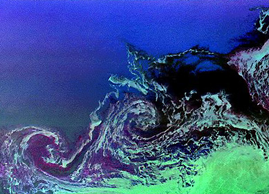

As the ice forms seasonally, the growing pack can take on swirl
patterns caused by eddy current circulation, as seen in this SIR-C
image:

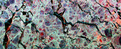
The nature of ice packs in the Arctic over a large area is exemplified
by this HCMM Vis image of the Chukchi Sea in the Bering Strait
between Alaska and Siberia. The ice in this scene is characterized
by a network of cracks, called leads, which open up during summer
breakup and refreeze when conditions demand.
Growth or decrease of the ice fields surrounding the Antarctic
as sensed by ESMR was pictured earlier in this Section. Changes
in ice cover for four years during the 1978-86 period as sensed
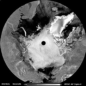
by SMRR are indicated in the top diagram below. On the bottom is a view
of the north polar regions, showing the prevailing ice cover,
made by NSCAT (the NASA Scatterometer).

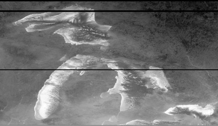
In the U.S. winter ice on the Great Lakes becomes a major impediment
to shipping and usually some or all of the lakes are closed to
normal travel. The status of ice cover is monitored daily by the
AVHRR on NOAA satellites, giving results like this thermal IR
image made on January 31, 1996 (ice is light-toned; clouds appear
very dark):

Code 935, Goddard Space Flight Center, NASA
Written by: Nicholas M. Short, Sr. email: nmshort@epix.net
and
Jon Robinson email: Jon.W.Robinson.1@gsfc.nasa.gov
Webmaster: Bill Dickinson Jr. email: rstwebmaster@gsti.com
Web Production: Christiane Robinson, Terri Ho and Nannette Fekete
Updated: 1999.03.15.