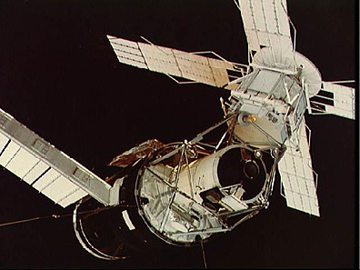

The first crew, led by Pete Conrad, was later sent into space on SIB, and occupied the Skylab after rendezvous. At that time, the mission was by far the longest and most complicated of any manned flight in the U.S. space program, and was highly successful (Canby, 1974) *.
The Skylab orbit, originally planned for a 28° inclination, was increased to 50° after protests by many of the scientists involved. This offered far more ground coverage than earlier American orbits that had been confined to 32° or less. As Michael Collins has pointed out *, a 50° orbit covers 3/4ths of the Earth's surface and areas with 90% of its population. The high altitude ( 438 km; 270 miles), also increased coverage.
As shown in the pre-Apollo table **, Skylab carried an arsenal of cameras, both hard-mounted and hand-held. During three occupations of this space station, the crews acquired several tens of thousands of photographs of the Earth, in addition to many astronomical pictures and other types of remote sensing images.
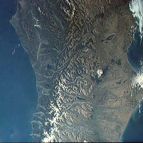
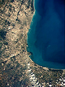
The view (top) of the South Island of New Zealand showing the great Alpine fault which abruptly truncates the snow-covered Alps, and the scene below it, a larger-scale picture of Chicago taken by the S190B camera, are typical of Skylab imagery:


The very last "Apollo" mission was flown in 1975, involving the first link-up with a Soviet Soyuz spacecraft (Shepard and Slayton, 1994)* . Although flown partly for political reasons, the ASTP mission generated a notable volume of useful scientific data both from on-board experiments and from photography. Experiment MA-136, under the direction of Farouk El-Baz, was rather more elaborate than previous 70mm photography. In particular, it involved the astronauts more in making judgmental selections of targets for visual observation, drawing upon the Apollo lunar experiences which had further demonstrated the value of the human eye. There was also a substantial program of ground (and water) truth data collection. Because of the high latitude of the Soviet launch site, the ASTP mission involved a high inclination, 51.8°, orbit that broadened the scope of regional coverage.
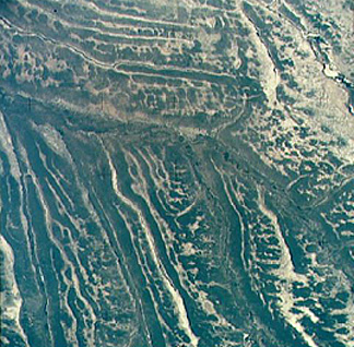
Some 2000 pictures were taken, about 750 of these of good quality (e.g., not cloud-obscured). Objections were diverse, covering geology, oceanography, and meteorology. A characteristic scene is this view of part of southwest Africa in Angola, where unique drainage patterns are controlled by broad, partially revegetated dune fields.

Photographs and other data from the ASTP mission were incorporated in a series of pamphlets for use by teachers, this being the first time education applications were a formal objective of the Earth photography.
A general review of all pre-Shuttle Earth photography has been published by Amsbury * . Equipment used in these missions, from Mercury through ASTP, has been tabulated by Kaltenbach in 1970, and can be reviewed here by clicking here which reproduces a series of tables from his report.
Code 935, Goddard Space Flight Center, NASA
Written by: Nicholas M. Short, Sr. email: nmshort@epix.net
and
Jon Robinson email: Jon.W.Robinson.1@gsfc.nasa.gov
Webmaster: Bill Dickinson Jr. email: rstwebmaster@gsti.com
Web Production: Christiane Robinson, Terri Ho and Nannette Fekete
Updated: 1999.03.15.