Parallax shifts are also attainable by flying along the same flight line at different altitudes and then printing the images to the same scale.
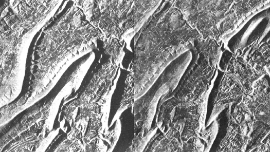
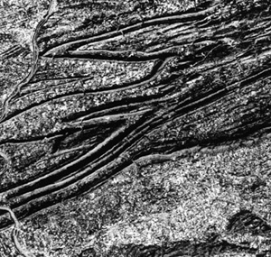
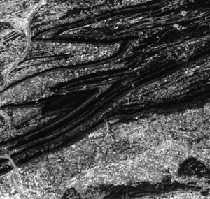
Stereo radar images from space can produce acceptable stereo models using multiple look angle (off-nadir) viewing. Both vertical and horizontal resolutions tend to be less than achievable by optical systems from comparable orbits. The vertical exaggeration may be significantly reduced owing to low B/H values. The stereopair below, showing volcanic terrain in Chile, acquired with the SIR-B L-band SAR from two different incidence angles (54° and 45°) looking in the same direction, has moderate exaggeration of a high relief scene.
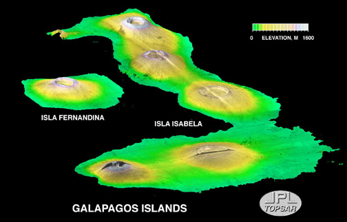
Multiple incidence angle imagery serves well in preparing perspective views, as demonstrated in this SIR-C oblique rendition of a group of volcanic calderas on two of the Galapagos Islands.
Synthetic Aperture Radar images generated simultaneously from two antennae on the same platform will have such a small base that they will not in themselves function as a stereo pair. But being composed of coherent radiation, signals from each matched to equivalent pixels in the other will show varying degrees of phase differences, indicative of partial interference, induced by variations in travel times between two adjacent points showing slightly different heights. When Earth curvature effects are removed and other adjustments are made, residual differences become a measure of terrain elevations. SAR Interferometry is a developing technique that you can learn more about by perusing a JPL home page dealing with this subject (http://southport.jpl.nasa.gov/scienceapps/dixon/report8.html). You can also access a relevant explanation showing how SIR-C interferometry was used to produce topographic information for this Long Valley, Calif. illustration.
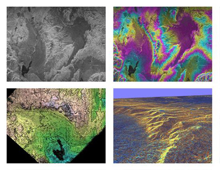
The upper left panel is an HH L Band image in which many bright-toned patches correspond to hilly rock and dark to smooth valley floors. Lake Crowley (dark) is at the lower left. The ridge is part of the Long Valley volcanic caldera (inactive). The upper right panel shows an interferogram derived by combining two L Band images taken in April and October, 1992 respectively. The colors relate to differences in signal phase caused by elevation differences. In the lower left is a topographic map derived from the interferogram; total relief is 1300 m (4330 ft). The lower right panel presents a 3-D perspective of this map made by "draping" a C Band image over the L Band topographic data.
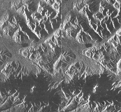
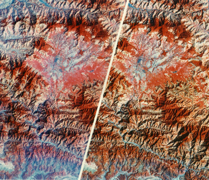
Now try for 3-D in this Landsat false color composite stereo pairing of images of Katmandu and surrounding Mountains in central Nepal, taken on March 20/21, 1977. The mount was prepared by the Environmental Institute of Michigan (ERIM).
Code 935, Goddard Space Flight Center, NASA
Written by: Nicholas M. Short, Sr. email: nmshort@epix.net
and
Jon Robinson email: Jon.W.Robinson.1@gsfc.nasa.gov
Webmaster: Bill Dickinson Jr. email: rstwebmaster@gsti.com
Web Production: Christiane Robinson, Terri Ho and Nannette Fekete
Updated: 1999.03.15.