 |
 |
| TM 1 | TM 2 |
|---|---|
 |
 |
| TM 3 | TM 4 |
 |
 |
| TM 5 | TM 6 |
 |
|
| TM 7 |
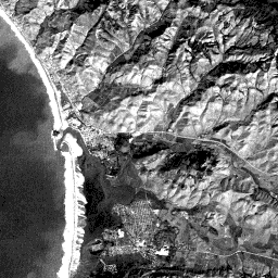
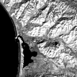
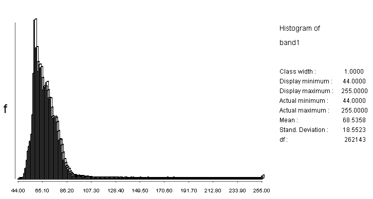
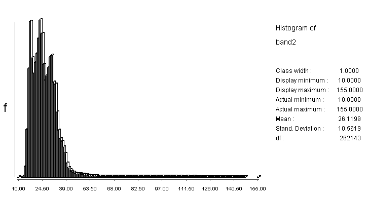
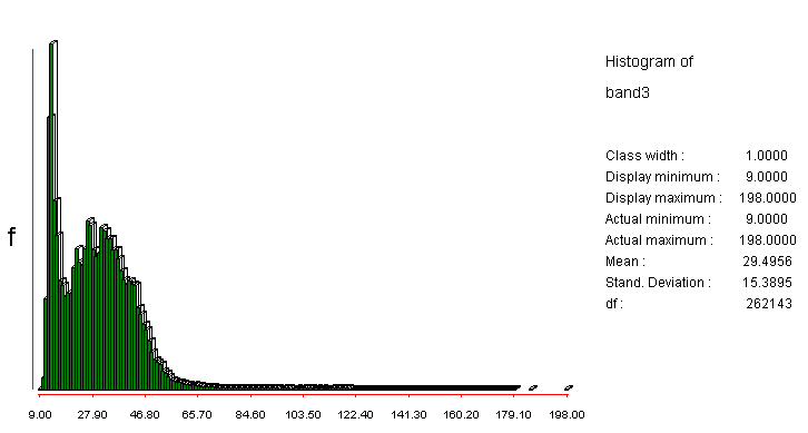
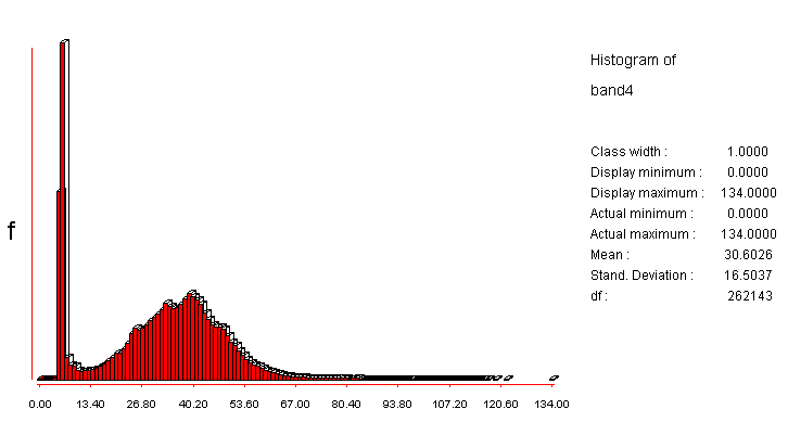
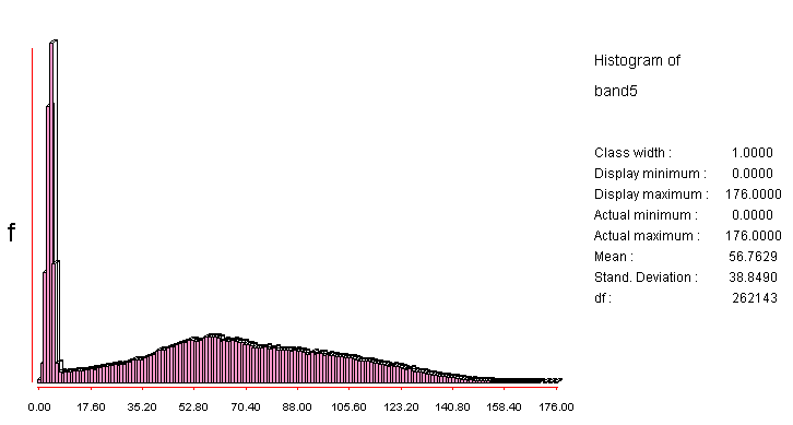
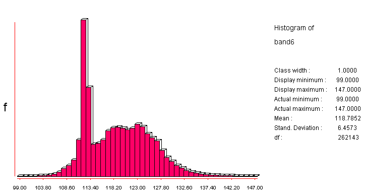
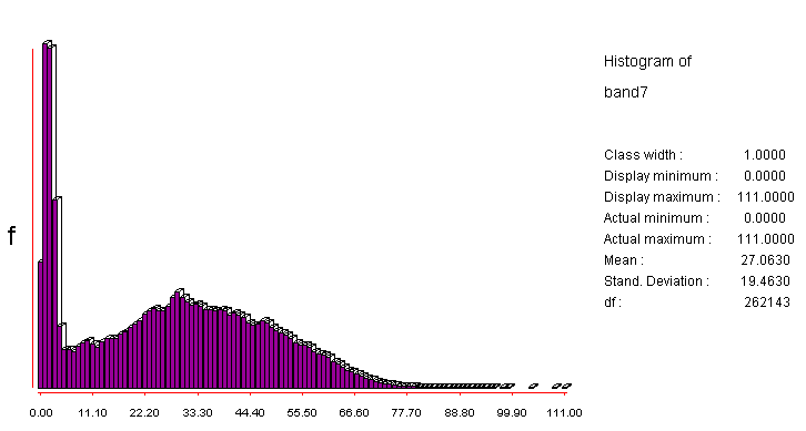
Each has its own specific tonal characteristics, along with distinctive shapes defined by tonal boundaries and patterns, that will help to identify ground features. You can view the histograms for each of the 7 bands (click to see each successively). histogram 1, histogram 2, histogram 3, histogram 4, histogram 5, histogram 6, histogram 7. Note that each histogram is bimodal, having one peak at very low values (water) and the second at various mid-DN values.
Lets start with TM band 1.
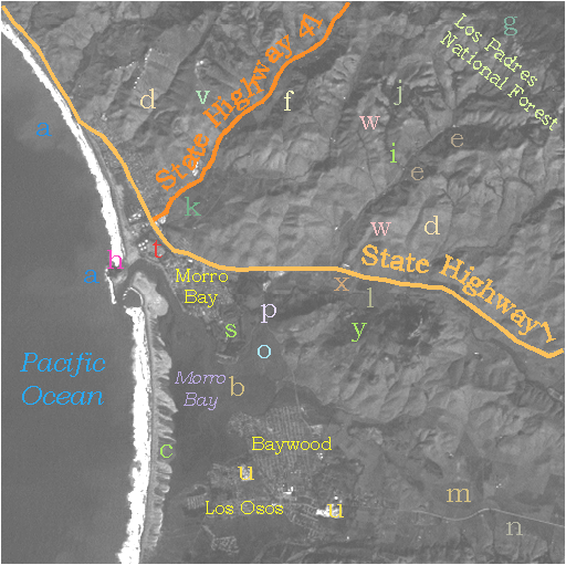
In band 1, bluish and greenish objects and areas in
the scene will generally be displayed in the image as lighter
gray tones than those representing other colors. Your immediate
first impression: the ocean on the left; hilly topography, especially
in the upper right two- thirds of the scene; several areas with
a distinctive criss-cross design that you should almost certainly
guess to be street patterns in the several towns; and one prominent
linear feature that is obviously a major highway together with
several similar features that are subsidiary roads. You may also
recognize some other surface features, both natural and manmade,
that we will shortly point out. Water in the scene is dominated
by the ocean. The tone for the open sea is surprisingly dark,
inasmuch as we think of sea water as being bluish-green. In all
bands, open water is usually at low gray tone levels, since solar
irradiation is largely absorbed. Reflectance is greater in the blue
and green bands but nevertheless is not high. But, it does increase
somewhat if silt and other sediments are present. In this band,
sediment is shown to be widespread both offshore and in the bay (its tones here are the lightest
found in any of the 7 bands) but deviations within the tonal pattern
such as at point a suggest actual variations in sediment load. Broad changes in
these patterns from the coast offshore represent tongues of sediment
(barely discernible in the aerial oblique photo) being distributed
by wave action. This will be better displayed in bands 2 and 3
where these tongues stand apart in sharper contrast. Note the
variable distribution of sediment within the more sheltered Morro
Bay, especially at b which is located just beyond the point of entry of a small river.
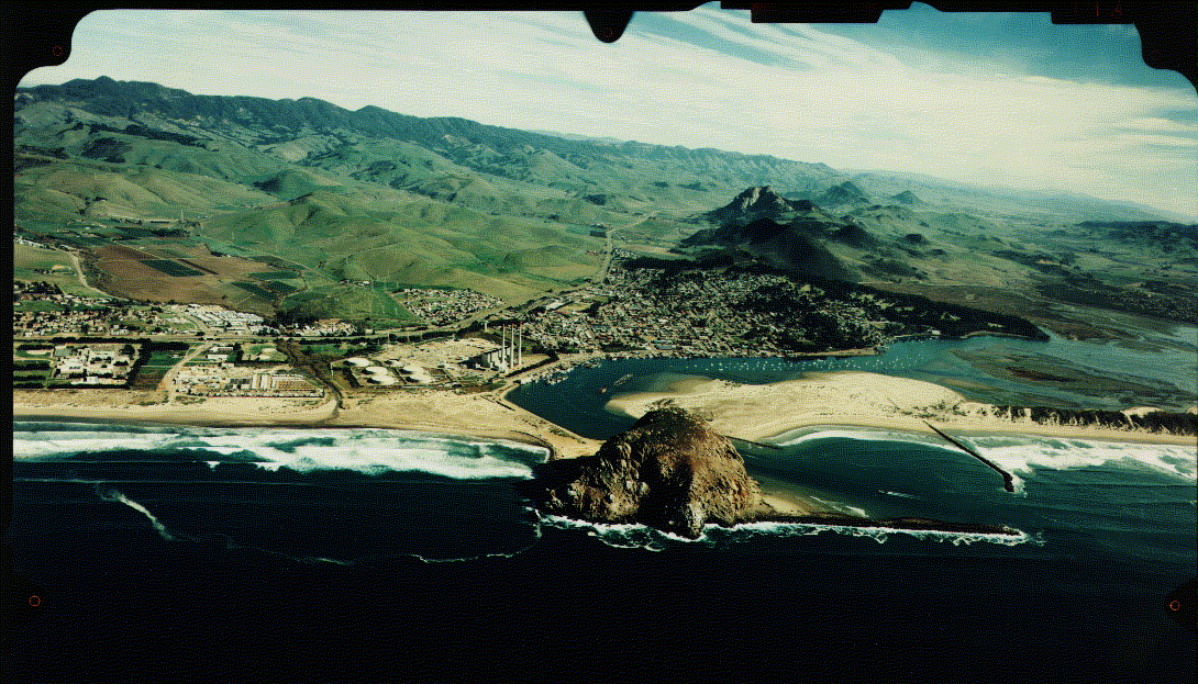
Right at the coastline itself, two very similar, but actually distinct long strips of very bright (whitish) tones extend from nearly the top to the bottom of the subscene. As you examine bands at longer wavelengths, the strip on the left (to the west) will change in character (becoming a mottled darker gray) whereas the one on the right stays about the same. If you are familiar with the West Coast shorelines, you probably surmised that the left strip corresponds to strongly breaking waves. These breakers are actually whitish to the eye when viewed from the ground, owing to their ability to scatter and reflect light, particular at shorter wavelengths, as the water is no longer smooth surfaced when it is churned up into a foam (the "head" on poured beer is a good analog). You probably now suspect that the right strip relates to highly reflective sand that has deposited as a sand or beach bar (this coastal feature commonly results from deposition of sandy particles that are dropped from long shore currents that cut across an inlet of shallow water [here, Morro Bay] ). A long jetty (see aerial oblique photo ) protects the inlet from these currents; note that this narrow structure cannot be seen in the image but its effect on the surf is evident. The darker patches (as at c) that interrupt this bar are coastal vegetation that tends to have low reflectances in all bands, even for band 4 which renders many other types of vegetation as much brighter.
Code 935, Goddard Space Flight Center, NASA
Written by: Nicholas M. Short, Sr. email: nmshort@epix.net
and
Jon Robinson email: Jon.W.Robinson.1@gsfc.nasa.gov
Webmaster: Bill Dickinson Jr. email: rstwebmaster@gsti.com
Web Production: Christiane Robinson, Terri Ho and Nannette Fekete
Updated: 1999.03.15.