The first is an aerial oblique photograph taken in mid afternoon (note shadows) on January 25, 1988 looking east at the
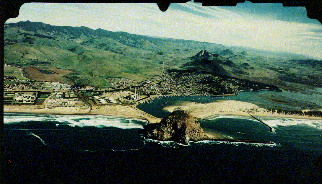
(credit: Golden State Aerial Surveys, San Luis Obispo, California, )
northern part of Morro Bay towards the hills in the background. The town of Morro Bay is situated in the center of the photo. We have digitized and enlarged this oblique photo to let you zero in on details within the immediate Morro Bay town area. Click on the above credit line or the image itself to call this up if you choose to take a closer look; use your scroll bars to visit areas initially off screen.
The second view was taken from a hill slope south of the Los Osos (Spanish for "The Bears") on the ground looking
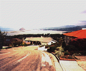
north across Morro Bay itself with the town of that name in the distance.
One surface feature stands out in both scenes. This is Morro Rock , a great erosional monolith made of granite that reaches a height of 175 m. (578 ft) above the Pacific.
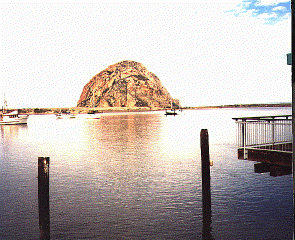
Technically, this is a "sea stack", an outlier of rock detached from the mainland as waves cut away at the shoreline. Here, the stack is joined to the land by a narrow deposit of sand caused by deposition in shallow water, producing what is known as a "spit". This granite mass underlies parts of the Santa Lucia Range , along whose upper elevations are California Oaks and other trees and foliage that make up the northernmost extension of Los Padres National Forest. The edge of this range, with a conspicuous granite peak, appears in this view taken from a point SE of Morro Bay.
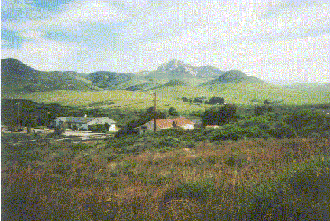
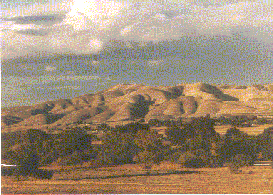
Denser forestation extends from the higher elevations (in the Landsat subscene, up to about 260 m or 860 ft ) into the lowlands along streams. Much of these hillsides however are covered mostly with natural grasses which attain their full greenery during the rainy season from about October through April. By May, these grasslands assume a pleasing golden yellow-brown color that persists through summer into early Fall. This provides a "trademark" for the California Coastal Ranges: this brownish background against which contrasts the deep greens of the oaks and other evergreens is illustrated here.
Code 935, Goddard Space Flight Center, NASA
Written by: Nicholas M. Short, Sr. email: nmshort@epix.net
and
Jon Robinson email: Jon.W.Robinson.1@gsfc.nasa.gov
Webmaster: Bill Dickinson Jr. email: rstwebmaster@gsti.com
Web Production: Christiane Robinson, Terri Ho and Nannette Fekete
Updated: 1999.03.15.