Remote sensing as a technology can be said to have started with the appearance of the first photographs. Many significant events followed, up to the launching of the Landsats, which will be the main focus of this Tutorial. To provide a background to milestones in remote sensing prior to the first Landsat, you can optionally click here to bring up an illustration consisting of the three part Table on History of Remote Sensing that appeared in the writer's (NMS) NASA Reference Publ. 1078 (now out of print) on The Landsat Tutorial Workbook. That review ends with events in 1979; subsequent major highlights up to the present are embodied throughout the Remote Sensing Tutorial. Suffice to summarize that these include the launching of several other satellite/sensor systems similar to Landsat, the insertion of radar systems into space; the proliferation of weather satellites; a series of specialized satellites dealing with environmental monitoring or with thermal and passive microwave sensors; the sophistication of hyperspectral sensors; and the maturation of a variety of sensors designed to gather imagery and other data for the planets and astronomical entities.
One of the best known devices that has served as a prime remote sensor for more than 150 years is the photographic camera. It captures a "portrayal" of targets exterior to it by concentrating (through a lens) EM radiation (normally, visible light) on to a recording medium (typically silver-based film) capable of displaying the target objects in their relative positions by variations in their brightness of gray levels (black and white) or color tones. Although the first, rather primitive photographs were taken as "stills" on the ground, the idea of looking down at the Earth's surface - yielding the so-called aerial photo - emerged in the 1840s with pictures taken from balloons. By the first World War, cameras mounted on airplanes provided aerial views of fairly large surface areas that proved invaluable in military reconnaissance. From then until the early 1960s, the aerial photograph remained the single standard tool for depicting the surface from a vertical or oblique perspective.
Satellite remote sensing can trace its origins to the early days of the space age (both Russian and American programs). It actually began as a dual approach to imaging surfaces using several types of sensors from spacecraft. First, by 1946, some V-2 rockets, acquired from Germany after World War II, were launched from White Sands, New Mexico, to high altitudes. These rockets, while not attaining orbit, contained automated still or movie cameras that took pictures as the vehicle ascended (see Section 12). Then, in the 1960s as man entered space, cosmonauts and astronauts in space capsules acted much like any tourists by taking photos out the window. In time, scene acquisitions of specific targets were scheduled in advance, although the 'naut was allowed some freedom to snap pictures at "targets of opportunity".
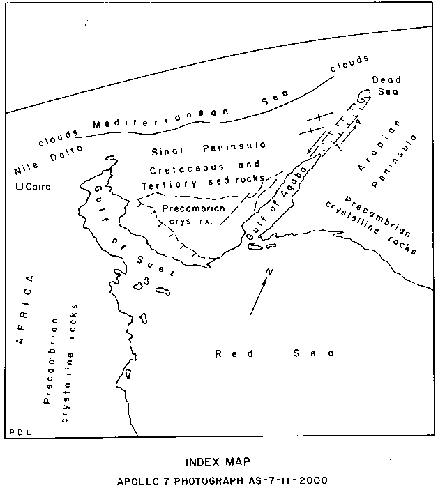 |
Sinai Peninsula and Red Sea |
|---|
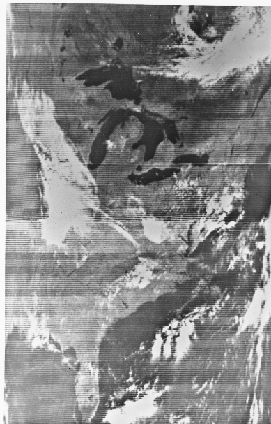
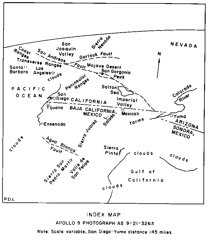 |
Gulf of California & Southern California |
|---|
During the '60s, the first sophisticated imaging sensors were incorporated in orbiting satellites. At first, these were basically TV cameras that imaged crude, low resolution (little detail; resolution refers to the size of the smallest contrasting object pairs that can be sharply distinguished) black and white pictures of clouds and the Earth's surface where clear. Several examples from the Nimbus satellite sensors give an idea of what can be seen.
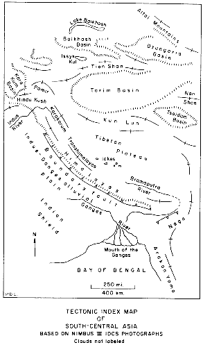 |
Eastern India, Bangladesh, Himalayas |
|---|
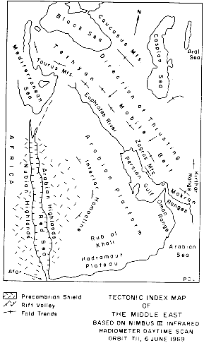 |
Saudi Arabia |
|---|
 |
Eastern North America |
|---|
Early on, other types of sensors were developed that "see" beyond the visible into both the near and thermal infrared. The field of view (FOV) was broad, usually 100s of kilometers on a side. Such synoptic areas of regional coverage were of great value to the meteorological community, so that many of these early satellites were "metsats" dedicated to gathering information on clouds, air temperatures, wind patterns, etc.
Code 935, Goddard Space Flight Center, NASA
Written by: Nicholas M. Short, Sr. email: nmshort@epix.net
and
Jon Robinson email: Jon.W.Robinson.1@gsfc.nasa.gov
Webmaster: Bill Dickinson Jr. email: rstwebmaster@gsti.com
Web Production: Christiane Robinson, Terri Ho and Nannette Fekete
Updated: 1999.03.15.